







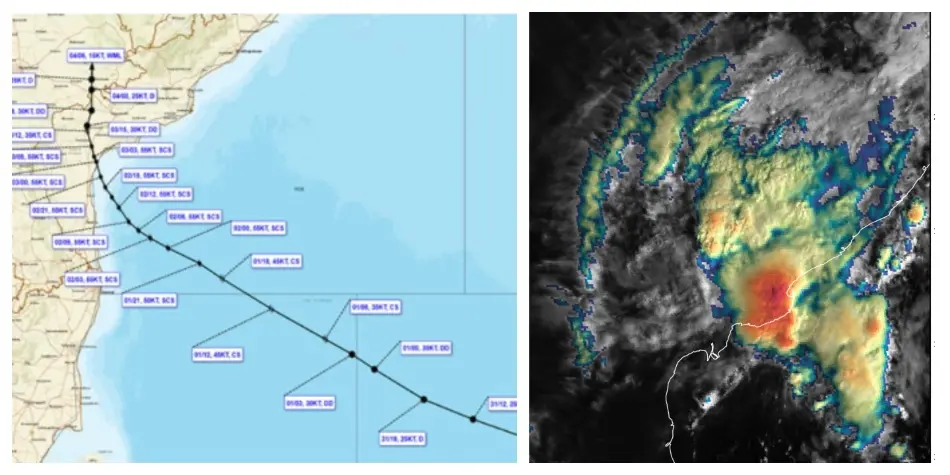
Bhubaneswar: Odisha is bracing for ongoing heavy rainfall in various regions, following the weakening of the remnants of the severe cyclonic storm Murasu into a well-marked low-pressure area, as reported by the India Meteorological Department (IMD) on Wednesday.
At 11:30 AM, the depression impacting eastern Telangana and the nearby coastal areas of Andhra Pradesh transformed into a well-marked low-pressure zone. It is expected to continue its northward trajectory and diminish further into a low-pressure area within the next 12 hours.
The IMD predicts that heavy rainfall and thunderstorms will persist across several districts in the state, prompting a yellow warning that will remain in effect for two days.
In its weather bulletin, the IMD has specifically warned of heavy rain in the districts of Koraput and Malkangiri until Thursday morning.
Additionally, thunderstorms accompanied by lightning and strong winds, with speeds reaching 30-40 km/h and gusts up to 50 km/h, are anticipated in Baleshwar, Bhadrak, Sundaragada, Jharsuguda, Baragada, Sambalpur, Debagada, Kendujhar, Mayurbhanj, Nuapada, Balangir, Kalahandi, Nabarangpur, Rayagada, Koraput, Malkangiri, and Gajapati during this period.
On November 5-6, thunderstorms with lightning and gusty winds are also forecasted for the districts of Kataka, Sundaragada, Jharsuguda, Baragada, Sambalpur, Debagada, Anugola, Subarnapur, Boudh, Nuapada, Balangir, Kalahandi, Kandhamala, Nawarangpur, Rayagada, Koraput, Malkangiri, Gajapati, Ganjam, Puri, Khordha, and Nayagada, where a yellow warning has also been issued.