





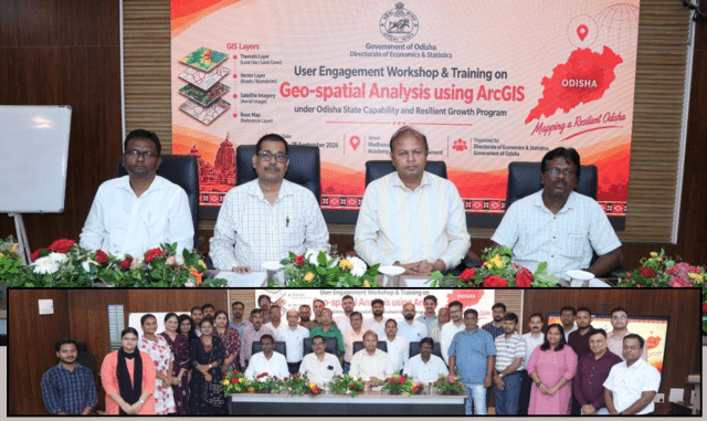
In a significant move towards enhancing digital governance and data-driven decision-making, the Directorate of Economics & Statistics (DES) of Odisha conducted a three-day workshop on “Geospatial Analysis through ArcGIS.” This event took place from September 23 to 25 at the Madhusudan Das Regional Academy of Financial Management (MDRAFM) in Chandrasekharpur, with the goal of updating the state’s statistical framework through advanced location intelligence.
This training initiative was part of the World Bank-supported Odisha State Capability and Resilience Growth Program (OSCRGP). It aimed to bolster spatial planning, mapping, and analytical skills among state representatives, providing them with essential knowledge on utilizing ArcGIS for development projects and statistical oversight.
During the opening session on September 23, Shri Manas Ranjan Samal, the Director of Economics & Statistics and Special Secretary, emphasized the importance of incorporating cutting-edge geospatial technologies into conventional statistical practices to enhance planning precision.
The closing ceremony on September 25 saw the presence of notable figures, including Shri Anuj Kumar Das Patnaik, IAS, Joint Secretary of the Planning and Convergence Department; Additional Secretary Shri Pradyumna Kumar Mahakud; and DES Director Shri Manas Ranjan Samal. These leaders praised the workshop initiative and engaged with participants, underscoring the critical role of spatial insights in crafting effective policy strategies.
A total of 38 individuals, including resource personnel, participated in the workshop, representing various organizations such as the Directorate of Economics and Statistics, Regional Planning units, District Planning & Monitoring Units (DPMU), Odisha Computer Application Centre (OCAC), Odisha Space Applications Centre (ORSAC), and Project Management Consultants.
Sessions were facilitated by specialists from ESRI India, who provided practical training in spatial analysis, data visualization, and the application of statistical methods in real-world scenarios. By empowering key personnel with advanced geospatial resources, Odisha is furthering its dedication to establishing a technology-driven, resilient, and transparent governance system.